South Cumberland State Park hiking covers more ground than most people expect. Over 30,800 acres. More than 85 miles of trail. Nine separate tracts spread across four counties. Tennessee’s largest state park, and most of it sits right here on the Cumberland Plateau in Grundy and surrounding counties.
The Getaway on Ranger Creek is approximately 20 minutes from the Stone Door trailhead. You don’t need a full day to get a real feel for what the park offers. But if you have a full day, the park can fill it. For a trail-by-trail breakdown, see our comprehensive South Cumberland guide.
What South Cumberland State Park Actually Is
Most people encounter the park as a collection of separate-feeling places: Grundy Forest, Greeter Falls, Stone Door, Fiery Gizzard, Foster Falls. These are all the same park, spread across multiple tracts. The largest is Savage Gulf State Park in Grundy and Sequatchie Counties, about 18,000 acres with 55 miles of its own trails.
The tracts cover terrain ranging from beginner day hikes to serious backcountry routes. The trail system connects several of them, which means a hiker with a full day can link significant mileage across very different country.
The Great Stone Door
Start here if you’re new to the park. The Stone Door Trail is 2 miles out and back from the ranger station near Beersheba Springs, with 167 feet of elevation gain. Easy rating. The first quarter mile is paved and wheelchair accessible.
The trail passes Laurel Gulf Overlook, then continues to the Stone Door itself: a 10-foot-wide, 150-foot-deep crack in the sandstone bluff at the plateau rim. Stone steps descend through it into the gorge below. It’s one of those features that’s hard to describe and easy to remember.
Register at the ranger station before you hike. Day hikers included. There are restrooms at the trailhead.
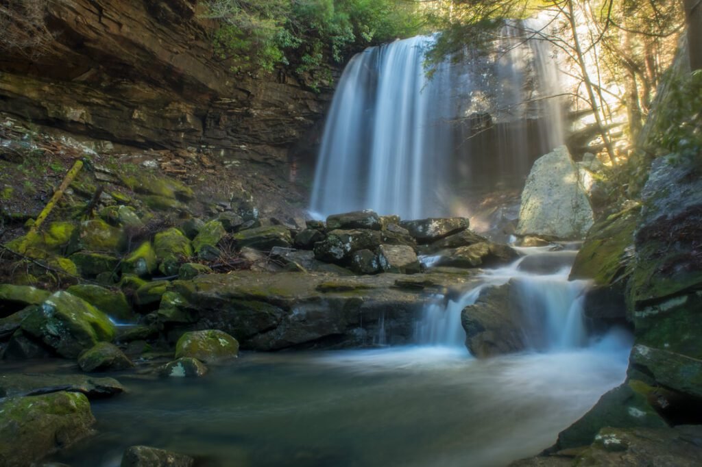
Savage Gulf
The Savage Gulf trail system is where the park gets serious. Three gorges carved into the plateau: Savage Gulf, Big Creek Gulf, and Collins Gulf, all draining into the Collins River. The terrain is sandstone bluffs, old-growth timber, waterfalls, and creek crossings.
Day hike options range from a few miles to 9 or more depending on which trails you combine. The gorges are remote. Bring a map and don’t count on cell service once you drop below the rim.
The Fiery Gizzard Trail
The park’s most well-known route connects Grundy Forest in Tracy City to Foster Falls, covering 12-plus miles one way through some of the most rugged terrain on the plateau. It’s nationally recognized as one of the best backpacking trails in the South. Day hikers typically do one end or the other.
The Grundy Forest trailhead is approximately 22 minutes from The Getaway on Ranger Creek. If you’re doing a section, the Grundy Forest end packs in more waterfalls in the early miles. You can find trail maps and current conditions on the Tennessee State Parks website.
South Cumberland State Park Hiking: What to Know Before You Go
All tracts require registration at the trailhead. Bring a paper map. Signage is solid but the park is large and gorge terrain makes navigation demanding. Dogs allowed on leash.
The park is free to enter. Trail maps are available at the South Cumberland Visitor Center in Monteagle and at each ranger station. The Friends of South Cumberland website has downloadable maps and detailed trail information for every tract.
Using The Getaway as Your Base
The Stone Door trailhead is approximately 20 minutes from the property. Greeter Falls, part of the same Savage Gulf tract, is about 12 minutes away. A full day can combine both without backtracking. The park has enough variety to keep serious hikers busy two days running without repeating ground. Our FAQ has the full list of trailheads and drive times from the property.
Check availability at thegetawayon.com. Real beds and a private deck waiting when you get back off the trail.